You are hereBlogs / WcP.Humor's blog / Photos: Santa Claus running in blizzard; White Christmas in London; skis in Capitol Hill; snow-covered Great Wall
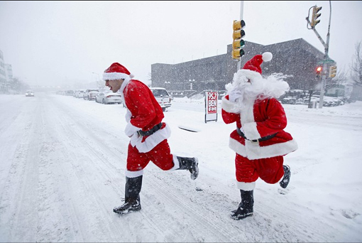
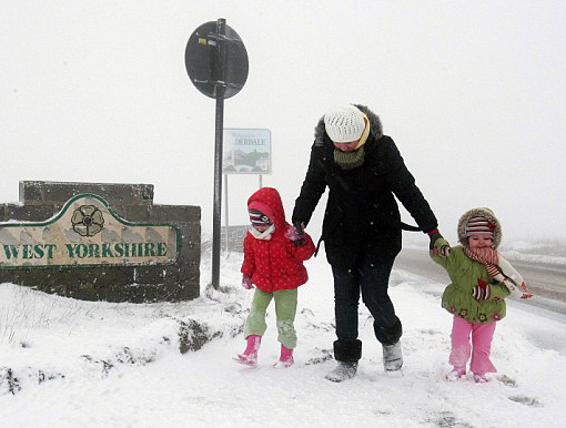
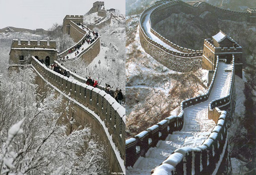
Photos: Santa Claus running in blizzard; White Christmas in London; skis in Capitol Hill; snow-covered Great Wall

(quote)
Air passengers are facing delays and cancellations as freezing temperatures and heavy snow sweep across Britain and much of Northern Europe. Many flights in and out of Manchester airport were cancelled today as staff cleared the runway of snow and ice. Many homes have been without power since Thursday night as a result of snow, an energy supplier said today. About 330 homes in the east of England were still without power supplies this morning, an EDF Energy spokesman said. He said staff had worked tirelessly to restore the power for thousands of homes affected by the severe weather. 'With snow and ice still across the region, travel between faults remains difficult,' he added.

All ferry services from Dover to Dunkirk, Boulogne and Calais are running and operators will continue to offer intensive shuttle services throughout the day. Michael Dukes, forecast manager for MeteoGroup UK, said the cold snap was set to continue for the next few days, although it was not yet known if milder weather would move in before or after Christmas. North-west England, the Pennines, Scotland and Northern Ireland saw the worst of the snow today.

'This is very cold Arctic weather from the North Sea,' he said. 'Snow showers are going to continue to threaten north-west England and much of Scotland. 'The cold spell is going to continue into tomorrow and Tuesday but there will probably be rather less in the way of snow. 'As at 12.40pm, the AA had attended around 7,000 breakdowns - almost as many as it would do for the whole of a normal Sunday,' he said.
Sussex, Kent and northern England, which have all been hit by snow, were especially busy. Kent Police said queues on the M20 had eased by 4am today after freight traffic on the A20 at Dover was turned around as part of Operation Stack, allowing tourist traffic to pass to the ports. As a result the backlog was cleared back to the Aycliffe roundabout, a spokeswoman said.

Kent Police Assistant Chief Constable Andy Adams said: 'There is now some snow on the M20 and we are working with Highways to grit the road so that we can continue with the progress already made to clear the backlog of vehicles. 'We expect further delays to motorists this morning using the M20 and would therefore reiterate the need to travel only if necessary and, if so, to drive prepared with warm clothing and food. 'Due to further snow moving across the county, several roads are being closed at this time until they are gritted and safe to pass.' As the cold snap continued unabated, bookmakers cut their odds on a white Christmas. William Hill was offering 2/1 on London seeing a snowfall on 25 December but meteorologists were only prepared to predict snow from the Peak District northwards, as well as North Wales and Scotland. William Hill has made Aberdeen 5/4 favourite for a seasonal fall.
It is 10 years since London and the South-East last saw snow on Christmas Day, but elsewhere - from Northern Ireland to the North-East and the South-West - many areas saw a white Christmas in 2004.

2 feet (61 cm) of snow piled up: Washington for a whole winter's snow in one day
The US east coast has been buried under as much as two feet of snow after the largest snowstorm to hit the region in almost six years. The weather caused traffic chaos in cities from Washington to Boston, with airports being closed and hundreds of flights grounded. Washington was worst hit in yesterday's storm, giving the capital its snowiest December on record. 'After six winters here in Washington of sub-par (below average) snowfall ... we picked up a whole season's worth in one storm,' said Weather Channel meteorologist Mike Seidel. Nearly two feet (61 cm) of snow piled up around Washington, where the average for an entire winter is just under 16 inches (40 cm).
It is the capital's heaviest snowfall since February 2003.

Artificial snowstorm brings chaos to Beijing
After the earliest snow to hit the capital in 22 years fell on November 1, the capital has again been shrouded in white, with more snow expected in the coming three days, the National Meteorological Centre said.
The China Daily, citing an unnamed official, said the Beijing Weather Modification Office had artificially induced both storms by seeding clouds with chemicals, a practice that can increase precipitation by up to 20 per cent. The office refused to comment on the report when contacted. On Tuesday, an official had said the storm was "natural".

City weather officials have previously said that such methods are aimed at alleviating a drought over much of north China, including Beijing, that has lingered for more than a decade. But residents have griped about the flight delays, traffic snarls, cancelled classes and other inconveniences of a surprise snow storm, saying officials could warn them if they are planning to toy with the clouds.
Beyond the day-to-day hassles, experts were reported as saying the weather manipulation had other undesirable side effects in the longer term. "No one can tell how much weather manipulation will change the sky," said Xiao Gang, a professor in the Institute of Atmospheric Physics at the Chinese Academy of Sciences. "We should not depend too much on artificial measures to get rain or snow, because there are too many uncertainties up in the sky." Zhao Nan, a Beijing engineer, was quoted as saying more than 5,500 tonnes of erosive snow-melting chloride used on city roads - nearly half the annual allotment - could "erode steel structures of buildings".

(unquote)
Photos courtesy of AP, PA, Nicholas Kamm / Agence-France Presses / Getty Images, Reuters, Spencer Platt / Getty Images, Xinhua, AFP / Frederic J Brown, Meteorology News, and theodora.com


